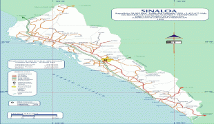
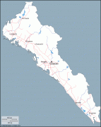
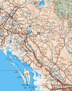
Sinaloa (Estado de Sinaloa)
 |
 |
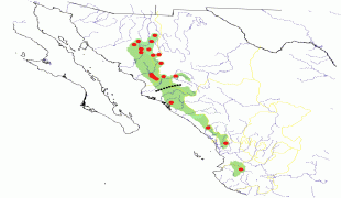
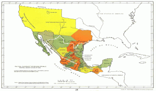
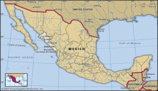
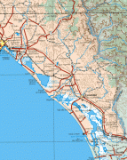
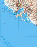
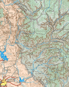
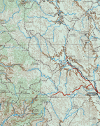
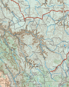
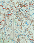
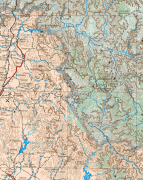
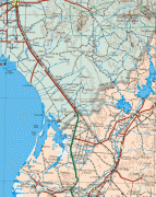
It is located in northwest Mexico, and is bordered by the states of Sonora to the north, Chihuahua and Durango to the east (separated from them by the Sierra Madre Occidental) and Nayarit to the south. To the west, Sinaloa faces Baja California Sur across the Gulf of California. The state covers an area of 58328 km2, and includes the Islands of Palmito Verde, Palmito de la Virgen, Altamura, Santa María, Saliaca, Macapule and San Ignacio. In addition to the capital city, the state's important cities include Mazatlán and Los Mochis.
Sinaloa belongs to the northern limit of Mesoamerica. From the Fuerte River to the north is the region known as Aridoamerica, which includes the desert and arid places of northern Mexico. Before European contact, the territory of Sinaloa was inhabited by groups such as the Cahitas, the Tahues, the Acaxees, the Xiximes, the Totorames, the Achires and the Guasaves.
In 1531, Nuño Beltrán de Guzmán, with a force of over 10,000 men, established a Spanish and allied Indian outpost at San Miguel de Culiacán. Over the next decade, the Cahíta suffered severe depopulation from conquest, smallpox and other diseases brought by Europeans.
The Spanish organized Sinaloa as part of the gobierno of Nueva Galicia. In 1564, the area was realigned: the area of Culiacán and Cosalá remained in control of Nueva Galicia, while the areas to the north, south and west were made part of the newly formed Nueva Vizcaya province, making the Culiacán area an exclave of Nueva Galicia. The first capital of Nueva Vizcaya was located in San Sebastián, near Copala, but was moved to Durango in 1583.
Starting in 1599, Jesuit missionaries spread out from a base at what is now Sinaloa de Leyva and by 1610, the Spanish influence had been extended to the northern edge of Sinaloa. In 1601, the Jesuits' movement into the eastern part of Sinaloa led to the Acaxee going to war. The Spanish eventually managed to reassert authority in the Sierra Madre Occidental region and executed 48 Acaxee leaders.
After the Mexican War of independence, Sinaloa was joined with Sonora as Estado de Occidente, but became a separate, sovereign state in 1830. The Porfiriato era was marked by the administration of Francisco Cañedo, who served multiple non-consecutive terms from 1877 to 1909. After the Mexican Revolultion, infrastructure projects and land reform consolidated the agrarian sector, which led to the state being named "the granary of Mexico".
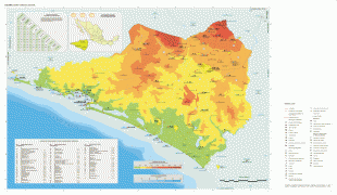
Map - Sinaloa (Estado de Sinaloa)
Map


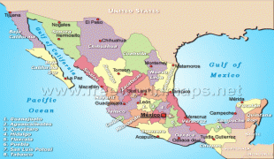

Country - Mexico


Currency / Language
| ISO | Currency | Symbol | Significant figures |
|---|---|---|---|
| MXV | Mexican Unidad de Inversion | 2 | |
| MXN | Mexican peso | $ | 2 |
| ISO | Language |
|---|---|
| ES | Spanish language |
